I've been experimenting a lot with the low stress routing profile lately, and I kept running into a few fundamental problems that send people into stressful situations they shouldn't be in. Here's one example, and what we've done about it.
The problem: crossing South Rd
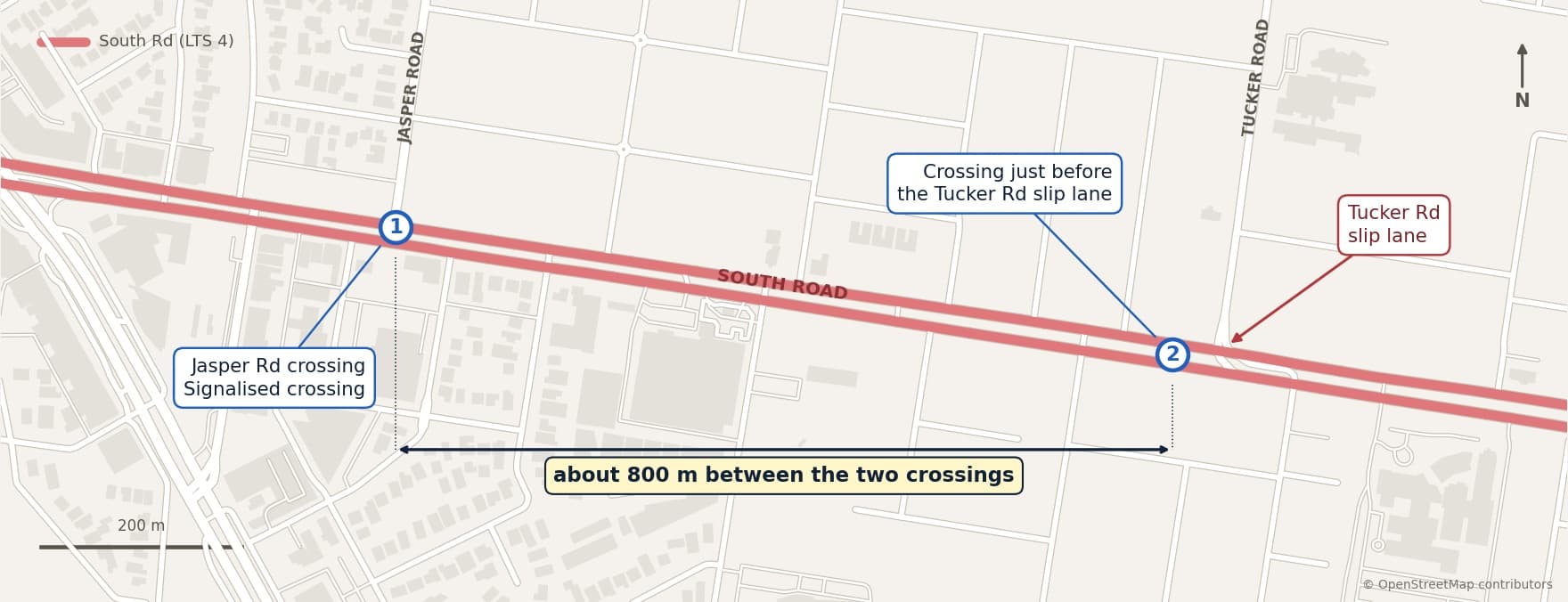
The section of South Rd between Nepean Hwy and East Boundary Rd is a 70 km/h road with three lanes each side and heavy traffic.
There's a signalised pedestrian crossing at Jasper Rd that gets you across onto the footpath. The next closest crossing is about 800 m away and does the same job. In both cases the road rules imply you should walk your bike across, but let's call that a necessary evil for crossing a road like this safely.
The problem is when you need to cross South Rd somewhere between those two crossings.
How do other apps handle it?
In short, they don't. Apps that use OpenStreetMap (OSM) for routing, like us, have the same blind spot. Here are Strava, RideWithGPS and Komoot.
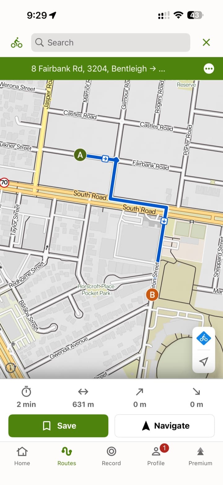
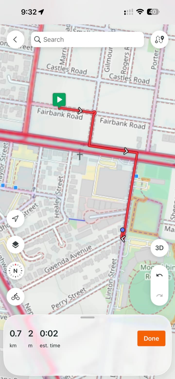
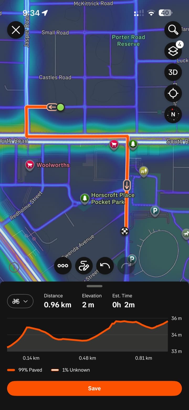
What these apps do is put you on South Rd itself. That's admittedly not that bad. There's a wide parking lane that gives you a good buffer from traffic. It's still LTS 4 in my opinion, because the traffic is heavy and fast and there's no separate barrier, but for confident riders it's fine.
The real issue comes when you need to get across. You're watching three lanes of traffic, moving into a slip lane while keeping an eye on oncoming traffic using the same slip lane, and then you need to cross another three lanes of busy traffic. It's just not safe.
Google Maps' default is to send you down South Rd and over the slip lane too. But it does offer other options, which take you over the lights and through a parkland cut-through. That's the safest route. Apple Maps does this by default, which makes it the best-performing cycling profile in this scenario.
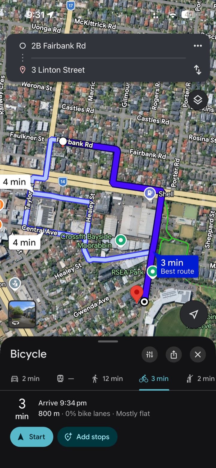
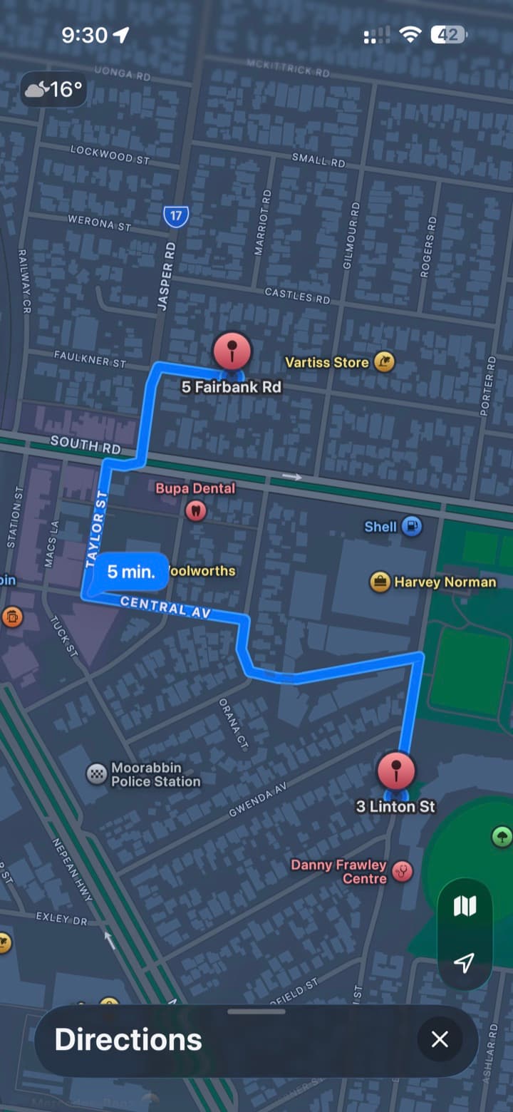
Our fix: LTS 4.5
So I came up with LTS 4.5. South Rd stays an LTS 4. It's not an ideal road to ride on, but for confident riders it's doable. The slip lanes are different. Even the most confident riders shouldn't have to cross them, and we needed a way to mark that. Hence LTS 4.5, shown in dark red.
I'd suggest it also applies to roads like Nepean Hwy, where there's no parking lane and the traffic is fast and heavy. I don't believe a rider should ever be on that road, and there have been plenty of incidents to suggest why.
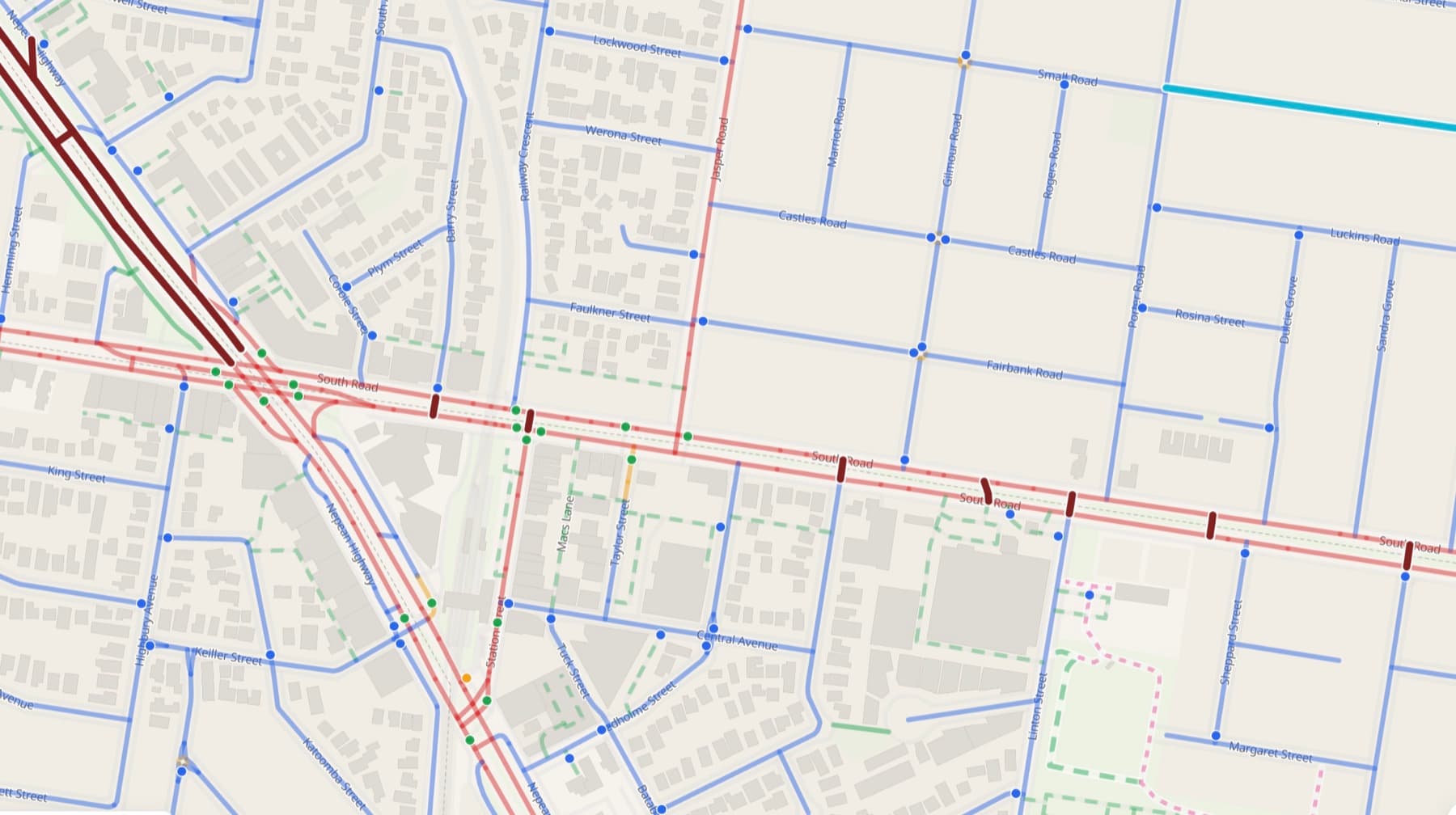
The new problem it exposed
LTS 4.5 worked. It sent riders around the slip lane. But it exposed a new problem. The route went through the Jasper Rd crossing (tick), down the closest LTS 2 road (tick), through a low-speed, low-traffic lane (tick), but then back onto the footpath of South Rd (cross).
Google and Apple were sending riders through the parkland cut-through. Why wasn't AusBUG, or any other OSM-backed mapping app for that matter?
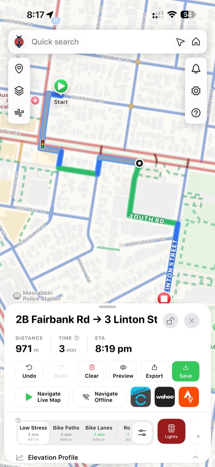
It exposes a flaw in relying on OSM that Google and Apple seem to avoid with their proprietary platforms. OSM won't send you up a vehicle crossing onto a footpath, most of the time, unless that's specifically mapped. It won't send you onto a footpath unless you're at the intersection of another street, at a pram crossing. But pram crossings don't only occur at intersections. In this case, and in many others, they don't.
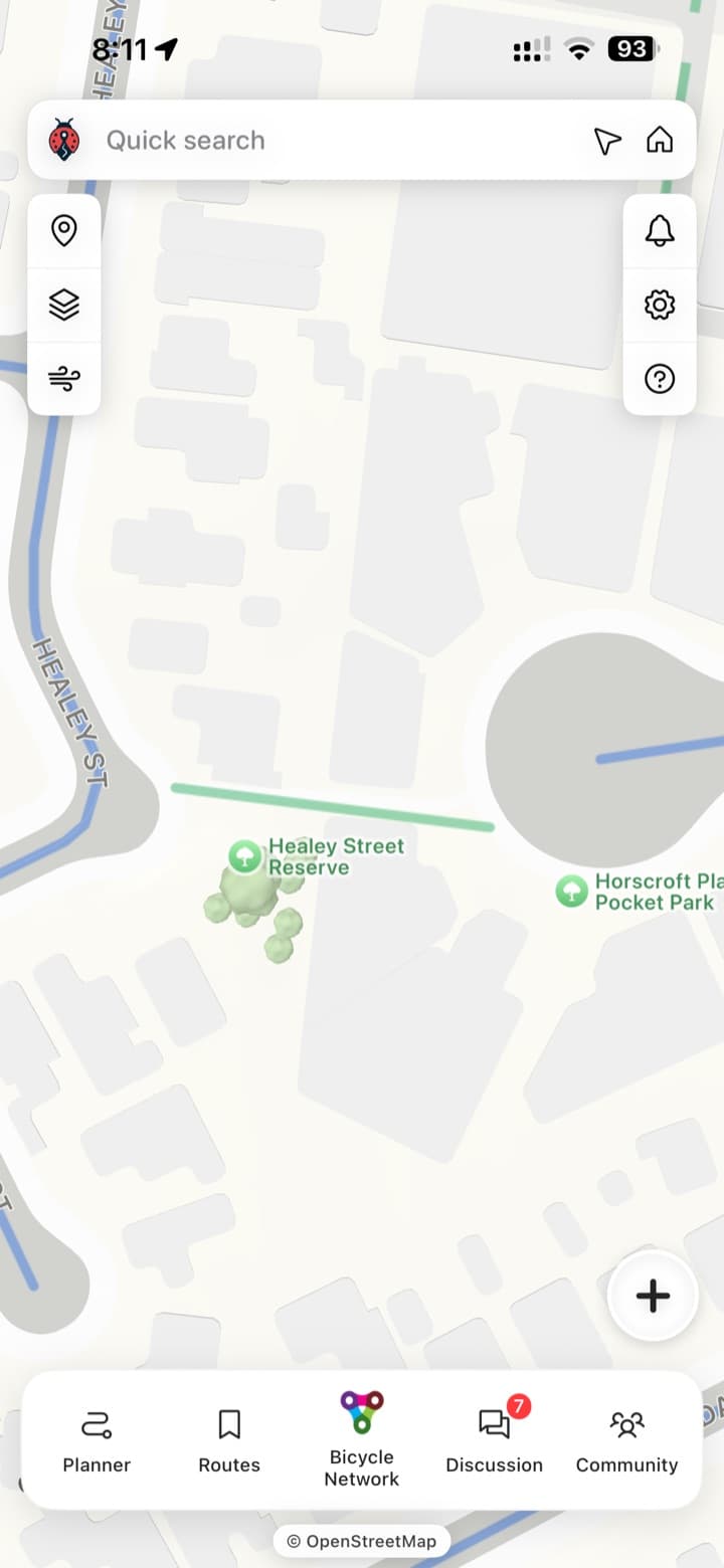
In the close-up below, OSM shows the cut-through path as a green island between streets. The road doesn't meet the path.
Where we've got to
The latest update lets the routing jump a kerb or use a vehicle crossing for small stretches, and lets mappers assign LTS 4.5 to busy roads, slip lanes or crossings. Success, for now.
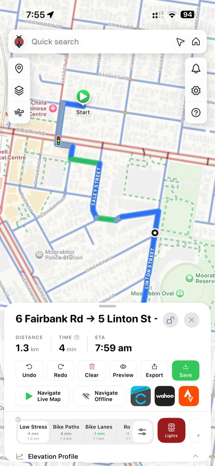
It's ready to use, but there might be edge cases. For example, it takes into account a fence, barrier or height difference between the road, the path and the cycleway, but we don't yet know how perfect that is.
It's only as good as the people using it
The success of this comes down to how many contributors use the LTS profile. I'm honestly a little blown away by how many people already have. LTS 1.5 has been a big success, and it already directs my own journeys down safer streets and into safer crossings. People are also assigning votes in the app, which is fantastic. Every vote means a safer ride.
But like OSM, it's going to take a concerted effort from peak bodies, BUG groups and passionate mappers before it's widely adopted.
Want to see how it works? Open the AusBUG LTS Map and tap More, then Map guide & scoring, for a brief overview of the LTS methodology and how a road gets its score. You can also start mapping: select a road and add your local knowledge.
A final thought
I'm really interested to hear what people think, because there's a lot going on here.
OSM is an incredible resource. I always knew it was good, but I never realised how passionate the mapping community behind it is. Without it, our favourite cycling apps simply wouldn't exist. Think RideWithGPS, Strava, Komoot, AllTrails and many more.
But OSM does so much that it highlights how much we need an LTS layer on top. I'm not saying I have all the answers, but think about it for a minute. If we want people to make short daily trips to a wide variety of places (the supermarket, school, shops, library, work), we can't rely on the infrastructure that's there now. Shared and separated paths don't run everywhere, and we aren't looking at major improvements in the next decade or two. When our best cycling apps send us across or along an extremely dangerous road or intersection, or miss a convenient cut-through, that's what keeps people from riding to make short trips near where they live.
And here's the thing: the infrastructure we need is already there. The quiet back roads, laneways and cut-throughs actually exist. Our mapping apps just don't use them.
My belief is that we can only fix this at a micro level. We can't rely solely on OSM. We need hyper-local data, like the LTS layer, and lots of it. If we can reliably direct people away from busy roads and onto cut-throughs and back streets, we can get more people riding, and give councils a chance to catch up.
I know we have a huge community of OSM mappers who follow along, so please tell me what you think. AusBUG is always going to be free, and I'm happy to make the LTS completely open source. Let's put our minds together and see how we can make this better.
Happy and safe riding,
Vince — DEV
Found this useful?
Comments
Sign in to join the conversation.